Sensys R4
Sensys R4
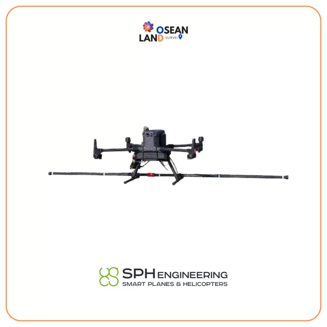
The MagDrone R4 is an ultra light weight magnetometer with 5 triaxial Fluxgates to be attached to any UAV capable to carry 2 kg of payload.
In opposite to the MagDrone R3, the MagDrone R4 is used for high resolution mapping in order to detect small and compact objects as well as structures in the ground, such as UXO or archaeological features.
Recommended applications:
- Searching for UXO (unexploded ordnance)
- Archaeology
- Surveying for any metal objects weighing a few hundred grams or heavier lying underground
Note, that general rule with magnetometer when it is necessary to detect artificial objects or artefacts - fly as low as possible. Recommended altitude for the tasks like UXO search - 1m above surface or even lower. That means that drone should be equipped with terrain following system (included in recommended magnetometer bundle).
Recommended drone to carry MagDrone R4: DJI M350/M300 RTK
What's in the set
MagDrone R4 magnetometer with 5x triaxial fluxgate magnetic sensors, sensor bar and data recorder
MagDrone Data Tool software
Power supply cable MagDrone R4 (XT30 plug for SkyHub)
USB cable to connect MagDrone R4 to Windows computer
Cable to connect MagDrone R4 to GPS-out interface of SkyHub
Mountings for DJI M350/M300 RTK drone
Manual
Transport hard case
UXO/landmines detection note
The system is capable to detect a range of items starting from hand grenades (the estimated sensor-target distance for detecting an object such as the F1 hand grenade is 0.5 m) till big UXO like aerial bombs at the distance of few meters.
While magnetometers can detect some types of landmines (for example M15, M6, TM-62M anti-tank mines; M16, PROM-1, OZM-3, OZM-4, OZM-72 anti-personnel mines and similar types with considerable amounts of ferrous metal), landmines search is not a direct application of magnetometers as they can’t detect most types of modern landmines. That means that the system never should be used to confirm absence of landmines (and small ordnance) in certain area but it can be valuable asset during Non-Technical Survey (NTS) or Technical Survey (TS) to confirm presence of UXO/landmines with considerable amount of ferrous metals.
Additional information
HS Code: 90158020 (meteorological, hydrological, geophysical instrument)
Packaging information: 112 x 29 x 11 cm, 12kg in transport box

